Pre-construction information & site hazard review
Know your site before work starts
A desk-based review of the hazards, constraints and seasonal restrictions for any UK site, in minutes. From new build and demolition to refurbishment and maintenance, with control measures and a report ready for your pre-construction information.
- No sign-up needed
- UK-wide coverage
- Official and open data sources
Example site with sample data
Built on official and open data
- Environment Agency
- Planning Data (MHCLG)
- Open-Meteo
- GBIF
- OpenStreetMap
- PlanIt
- postcodes.io
Why First Recce exists
Most site hazards are known long before anyone finds them
Flood zones, protected trees, bat records, overhead lines and seasonal restrictions are published, but spread across dozens of sources. They are usually pieced together late, when a contractor is appointed or work stops on site. First Recce brings them together at the outset, so project teams can design, programme and price around these variables rather than react to them.
Found on site
Planned from the outset
A bat roost is found during demolition in June. Work stops until a licence is granted.
Bat surveys are booked for May and demolition is programmed for the autumn.
An overhead line is spotted as the crane arrives on site.
Crane positions and goalposts are agreed with the network operator at design stage.
A concrete pour is lost to a hard frost in January.
Typical frost days are in the programme and cold-weather concreting is planned.
Earthworks spread Japanese knotweed across the whole site.
A knotweed survey and management plan are in place before ground works.
Roots of a protected tree are damaged, bringing council enforcement.
TPO trees are identified and fenced from the first day on site.
Why plan ahead
Safer sites, fewer surprises, better records
Hazards found at the planning stage are the cheapest and safest to deal with. Found on site, they become accidents, delays and cost.
Support your CDM 2015 duties
Clients must provide pre-construction information and principal designers must help gather it. The report covers many of the existing-site topics in HSE guidance (L153): services, flood risk, protected sites, access and neighbouring development.
Design out risk early
Identify overhead lines, flood zones and restricted access while plans can still change, so hazards can be eliminated or reduced rather than managed on site.
Protect the programme
Spot ecology survey windows, Tree Preservation Orders and listed building consent before they reach the critical path. Missing a bat survey season can mean a year's delay.
Stay within wildlife law
Disturbing protected species or spreading invasive plants can lead to prosecution, fines and costly stoppages. Know what has been recorded nearby before clearance begins.
A dated record of your checks
Every report is timestamped and lists its data sources, giving you evidence of the desk study carried out for project records, tenders and client reports.
Brief the whole team
Share a link or PDF with designers, contractors and site teams, and use the control measures in inductions, method statements and toolbox talks.
Features
Everything the team needs to know, in one place
Summary
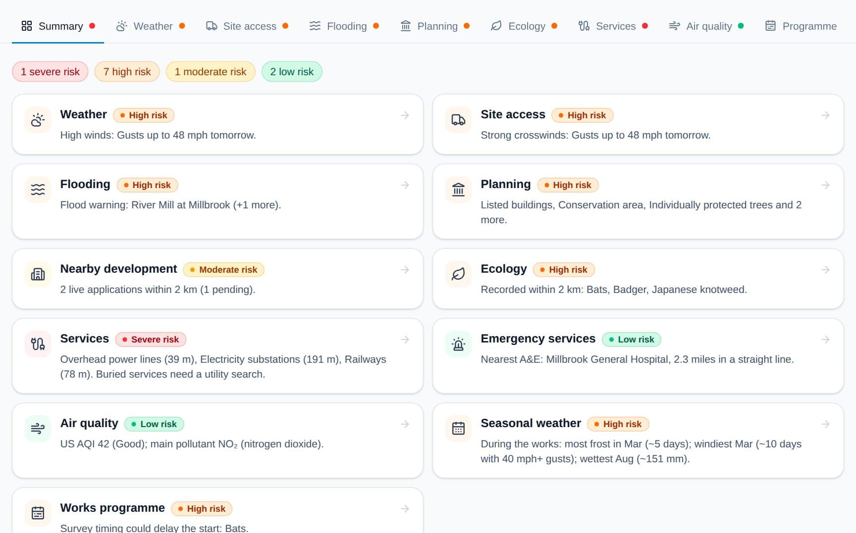
Every hazard for the site on one screen
Each topic is rated from low to severe with its key finding, so the team can see where to focus before reading the detail.
- Colour-coded risk for each topic
- One click through to the detail and control measures
- Shareable link for the whole team
Works programme
Plan around the seasons, not against them
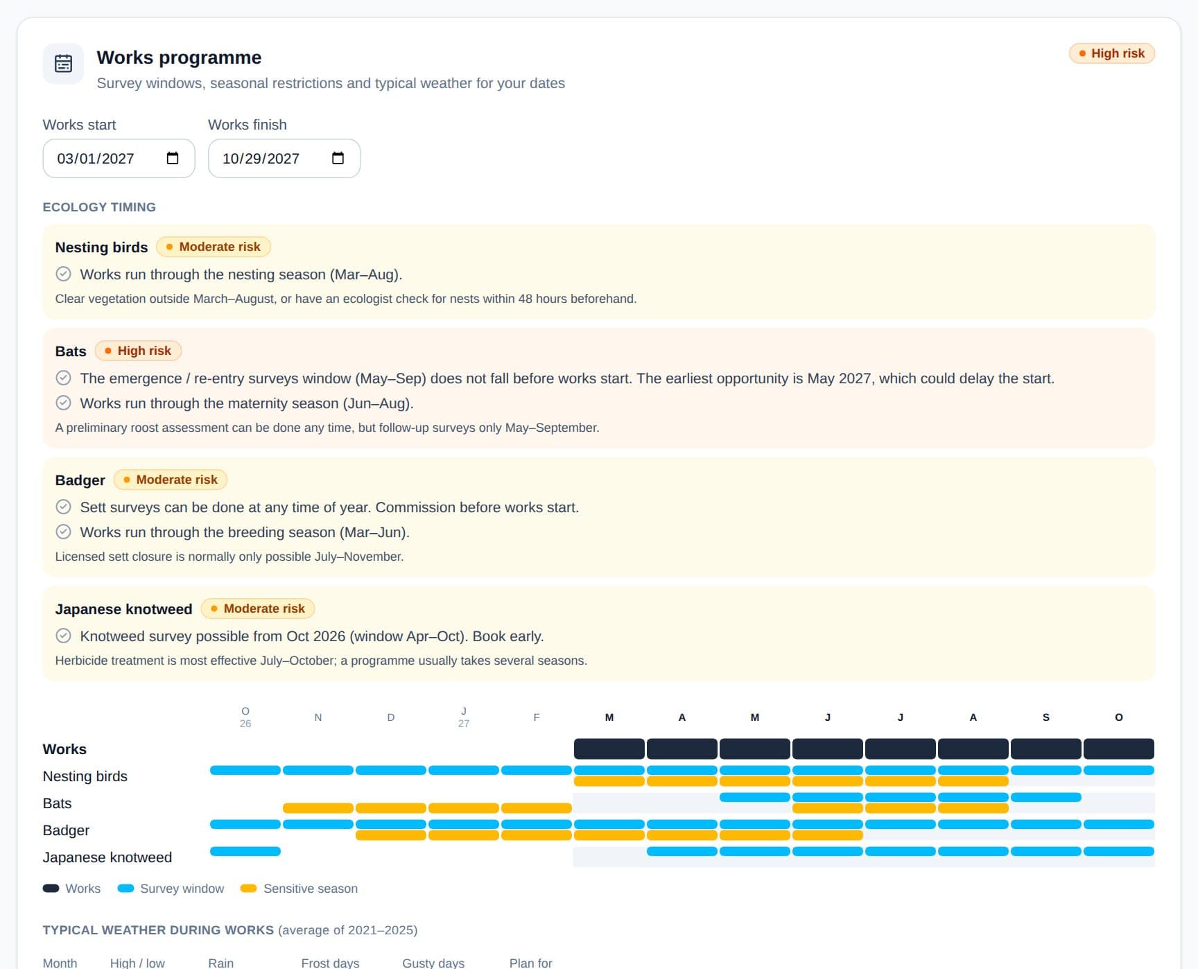
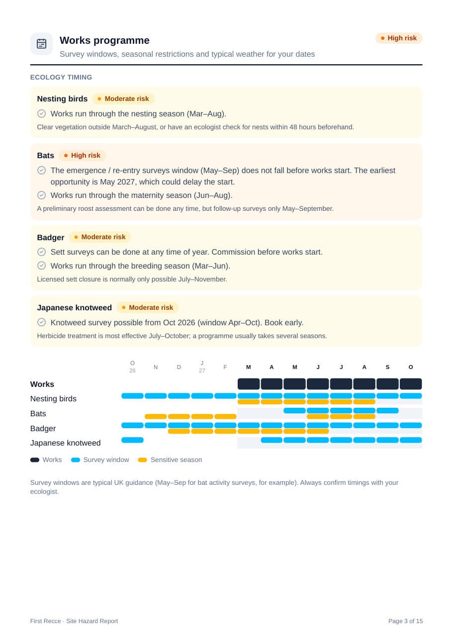
Enter your works dates to see which ecology surveys must be booked, which seasons the works run through, and what the weather typically does each month.
- Survey windows checked against your start date
- Nesting, breeding and hibernation seasons
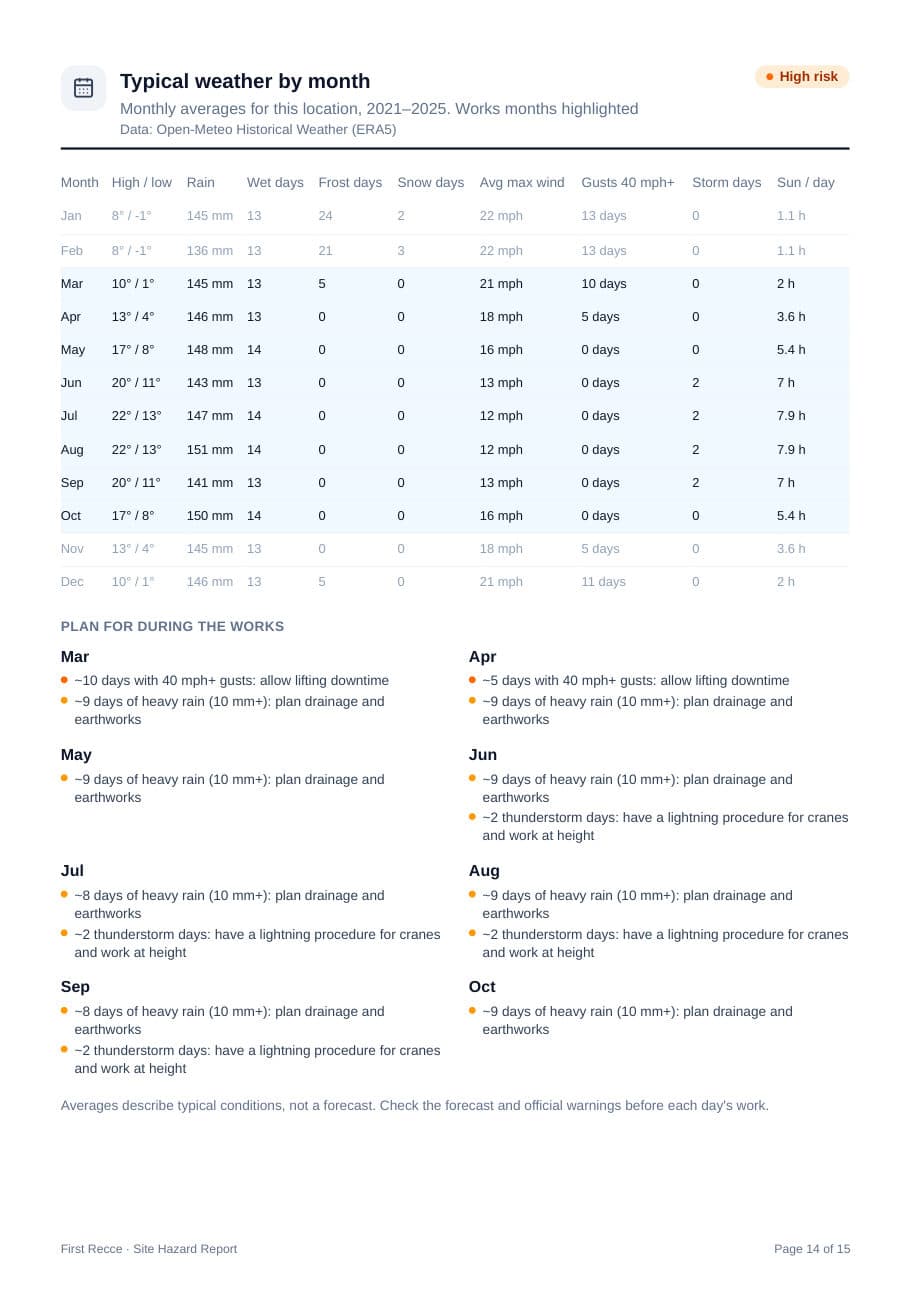
- Frost, wind, rain and storm days for every month
Planning constraints
Consents and designations before they reach the critical path
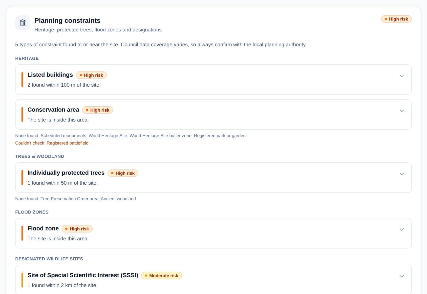
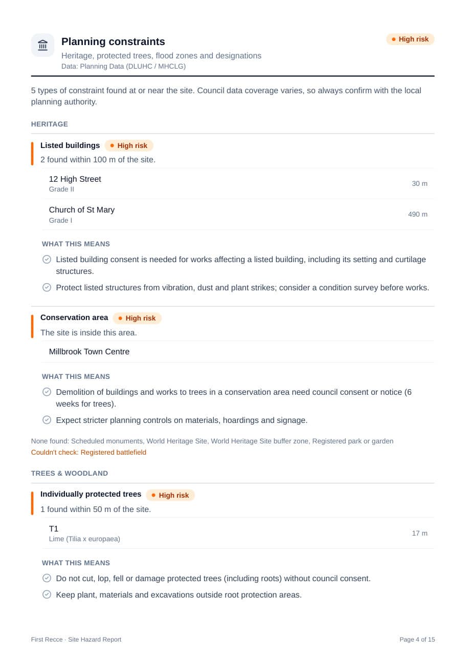
Listed buildings, conservation areas, Tree Preservation Orders, flood zones and designated wildlife sites, each with what it means for your works.
- Distances from the site to each feature
- Links to the official records
- Live planning applications nearby
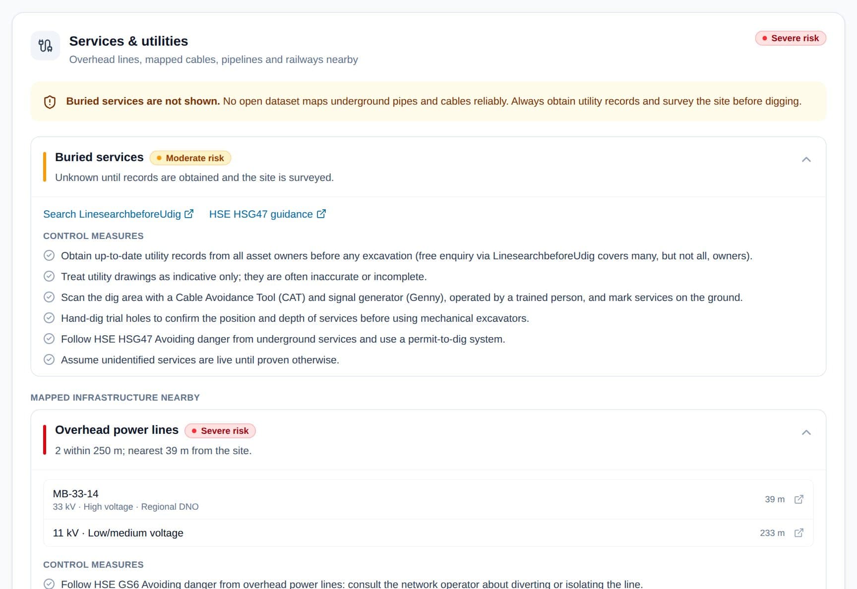
Services & utilities
Know what is overhead and alongside the site
Overhead power lines graded by voltage and distance, substations, pipelines and railways, with a buried services checklist based on HSE guidance.
- HSE GS6 and HSG47 control measures
- Nearest distance to each line
- Link to a utility search for buried services
The report
Ready for your pre-construction information file
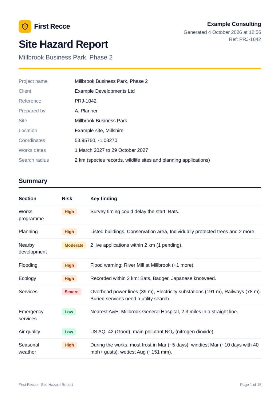
Add your company and project details and save a branded A4 report as a PDF. It is laid out to be read, filed and shared with designers, contractors and clients.
- Cover page with your company, project details and a risk summary
- Works programme first, then planning, flooding, ecology, services and air quality
- Typical weather for every month of the works, not a forecast that dates
- Every hazard expanded with its control measures
- Data sources, licences and a clear disclaimer
Coverage
What each search checks
- UK
Weather
7-day forecast rated against crane and MEWP wind limits, cold-weather concreting, heat, lightning and UV.
- UK
Site access
Driving and delivery hazards for staff and plant: ice, fog, crosswinds and wet roads.
- England and Wales
Flooding
Live Environment Agency flood alerts and warnings within 15 km (England), plus flood zones in England and Wales.
- England and Wales
Planning constraints
Listed buildings, conservation areas, Tree Preservation Orders, scheduled monuments, Green Belt and brownfield land.
- UK
Nearby development
Live planning applications within 500 m that could be on site at the same time as your works.
- UK
Services & utilities
Overhead power lines, substations, pipelines and railways nearby, plus a buried services checklist.
- UK
Emergency services
Nearest A&E with driving time, fire, ambulance and police stations, and defibrillators, with a flag for remote sites.
- UK
Ecology
Protected species records within 2 km, invasive plants such as Japanese knotweed, and SSSIs and other designated sites.
- UK
Air quality
Current air quality index, particulates and pollutants, with dust control measures.
- UK
Works programme
Enter your dates to see ecology survey windows, seasonal restrictions and typical weather for every month of the works.
- PDF
Printable report
A branded report with your project details, a risk summary and control measures, ready for your pre-construction information file.
Who it's for
For everyone who plans, designs and delivers work
Clients & developers
Gather pre-construction information before appointing designers and contractors.
Principal designers
Identify site hazards and constraints early enough to design them out.
Contractors & site managers
Inform tenders, construction phase plans, logistics and site briefings.
H&S and CDM advisers
Carry out a consistent, documented desk study for every site.
How it works
- 1
Search the site
Enter a postcode, town or village, or use your current location.
- 2
Refine the details
Drag the pin to the exact site and add your works dates.
- 3
Review and report
Work through each hazard, then print or save the report as a PDF.
FAQ
Questions
Does First Recce make my project CDM compliant?
No tool can do that on its own. First Recce helps clients, principal designers and contractors gather and record information about the existing site, which forms part of the pre-construction information. Duty holders remain responsible for their CDM 2015 duties and should use competent advice.
Where does the data come from?
Public and open sources including the Environment Agency, the government's Planning Data platform, Open-Meteo (Met Office and ECMWF models, ERA5 history), GBIF species records, OpenStreetMap and council planning portals via PlanIt. Every report lists its sources.
Which areas are covered?
Weather, ecology, services, air quality and nearby planning applications cover the whole UK. Planning constraints and flood zones cover England and Wales (Welsh data from Cadw and Natural Resources Wales via DataMapWales). Live flood warnings cover England. For Scotland and Northern Ireland, and for live warnings in Wales, the report points you to the relevant agency.
How up to date is it?
Flood warnings refresh every 15 minutes and forecasts every 30 minutes. Planning and ecology records are refreshed daily to weekly, depending on the source. Each report is timestamped.
Does it show buried services?
No. No open dataset maps underground pipes and cables reliably, so First Recce shows mapped overhead and nearby infrastructure and a buried services checklist. Always obtain utility records and survey the site before digging.
Can I add my company details to the report?
Yes. Add your company, project name, client, reference and notes when you create the report. They are remembered on your device for next time.
Check your next site
Search a postcode or place to start. It takes a couple of minutes.